Why island hopping flights are unlike anything else in aviation
Most airline routes are simple A-to-B affairs. Board the plane, fly, land. But a handful of services around the world defy that formula entirely, threading through chains of remote islands in a single continuous journey, connecting communities that have no other practical link to the outside world. These are island hopping flights, and they are among the most operationally complex, historically rich, and genuinely moving experiences in all of commercial aviation.
This article profiles the three most remarkable island hopping services operating today: the legendary United Airlines Island Hopper across the Central Pacific, the understated Nauru Airlines Australia-North Pacific Connector , and the surprising Air France Caribbean Island Hopper running from Miami through two French overseas territories all the way to South America. Each route tells a different story, about geography, history, diplomacy, and the enduring human need to stay connected.
1. United Airlines Island Hopper: the Pacific marathon
No island hopping route captures the imagination quite like United Airlines' Flight 154, universally known as the Island Hopper . Departing Honolulu every morning, a Boeing 737-800 touches down at six stops across the vast Central Pacific before finally arriving in Guam approximately 15 hours and 4,000 miles later. This is not just a flight, it is an expedition.
The route was originally established by Continental Airlines in the 1960s, when Boeing 727s would land on coral runways at some of the world's most isolated atolls. United inherited the service when it merged with Continental in 2012 and continues to operate it today, carrying passengers, cargo, and mail that would otherwise take weeks to arrive by ship. For many of these islands, this Boeing 737 is the only commercial air link to the world.
Source: Navigraph, Featured Route: United Island Hopper , written by Jason Sokoloff, Technical Specialist at Navigraph and Embry-Riddle Aeronautical University graduate. We strongly recommend reading the original for a detailed first-person account of flying every leg.
The full route: Honolulu to Guam in six hops
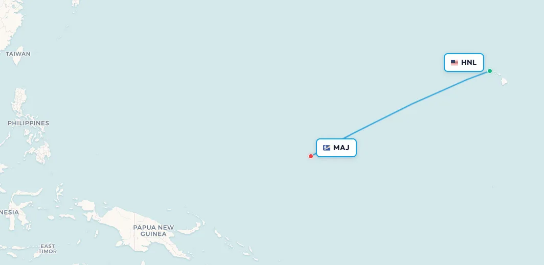
Leg 1: Honolulu (HNL) → Majuro, Marshall Islands (MAJ)
Flight: UAL 154 | Distance: ~2,300 miles | Flight time: ~5 hours 10 minutes
The first leg is the only true long-haul ETOPS operation of the day. Leaving Honolulu's picturesque reef runway loaded with 43,000 lbs of fuel, the 737-800 spends over five hours crossing open ocean. Because the flight enters ETOPS airspace almost immediately after departure, the crew carries a tech ops team member plus spare parts in the hold, because there is no maintenance support at any of the upcoming stops. After 400 miles of nothing but blue, the pale green silhouette of Majuro Atoll finally appears on the horizon. Majuro is the capital of the Marshall Islands, a nation of 1,200 islands spread across 750,000 square miles of ocean but with a total land area smaller than Washington D.C. The airport blends so perfectly into the sand that it can be hard to spot from the downwind leg of the circuit.
📥 Download route data (CSV) | 🗺️ Track this route in the app
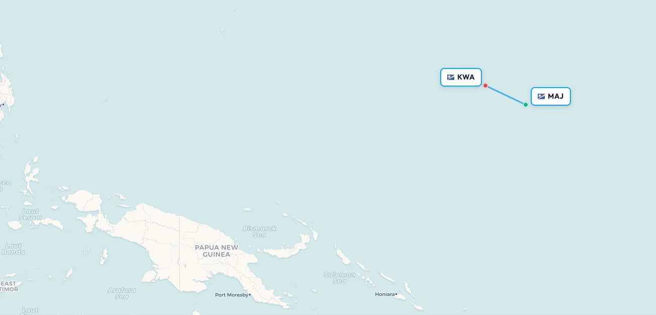
Search flights Honolulu → Majuro Search flights HNL → MAJLeg 2: Majuro (MAJ) → Kwajalein (KWA)
Flight: UAL 154 | Distance: ~250 miles | Flight time: ~57 minutes
The shortest leg of the day takes just under an hour. Kwajalein's airfield, today called Bucholz Army Airfield, was originally built by the Japanese in 1943 as part of a fortified naval base, stormed by US forces during Operation Flintlock in 1944, and today remains a classified active US Army installation. Photography is strictly forbidden on the ramp. Through-passengers must remain on board, and the ground stop lasts just 40 minutes. For most travellers, it is the closest they will ever come to a restricted military atoll.
📥 Download route data (CSV) | 🗺️ Track this route in the app
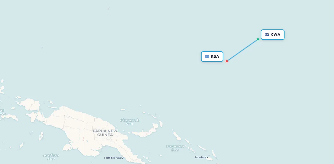
Search flights Majuro → Kwajalein Search flights MAJ → KWALeg 3: Kwajalein (KWA) → Kosrae (KSA)
Flight: UAL 154 | Distance: ~560 miles | Flight time: ~1 hour 17 minutes
Kosrae International Airport serves the easternmost state of the Federated States of Micronesia. Built on an artificial island 150 metres off the coast and connected to the main island by causeway, it opened in January 1984 and quickly became the lifeline of the local economy. The 5,200-foot runway juts out directly over the ocean alongside terrain rising to 2,000 feet AGL, demanding an offset visual approach of about 8 degrees and a precision touchdown.
📥 Download route data (CSV) | 🗺️ Track this route in the app
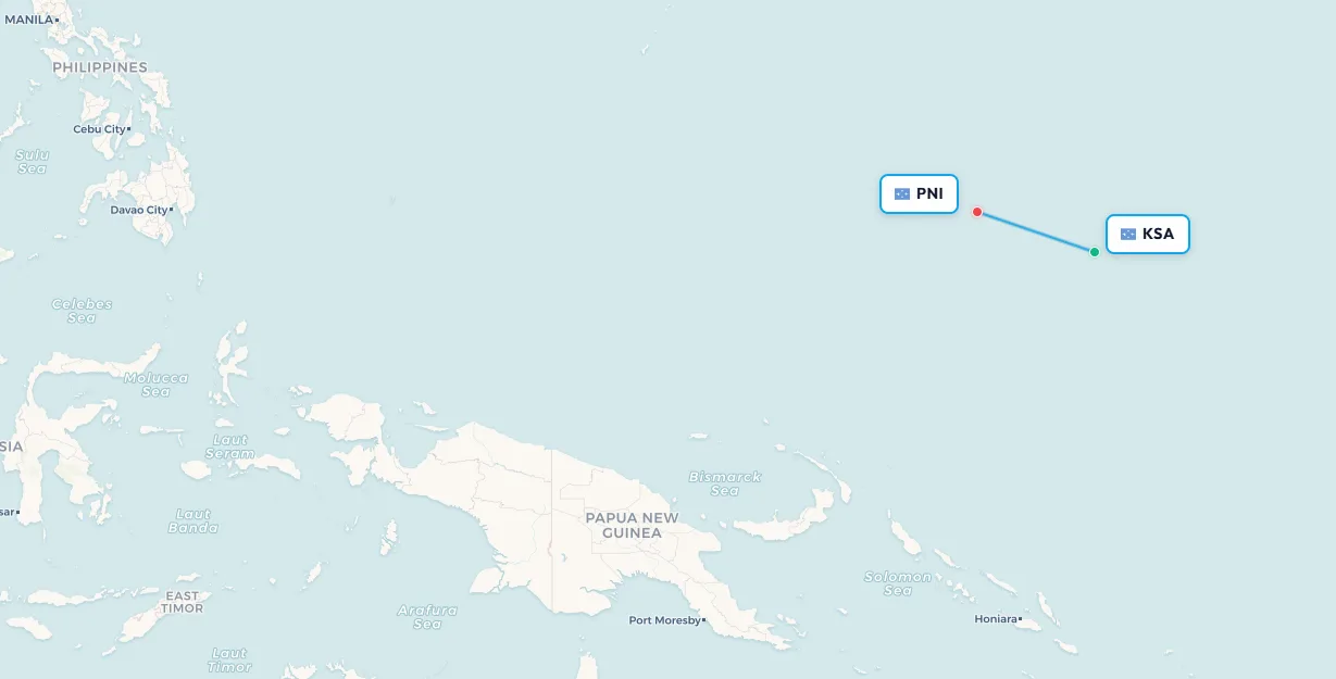
Search flights Kwajalein → Kosrae Search flights KWA → KSALeg 4: Kosrae (KSA) → Pohnpei (PNI)
Flight: UAL 154 | Distance: ~400 miles | Flight time: ~1 hour 5 minutes
Pohnpei is the largest and most populous state of the FSM, and arguably its most captivating. Local legend holds that seafaring ancestors created the island by piling earth and stone atop a shallow reef. The island receives 4,775 mm (188 inches) of rain per year at the airport, making it one of the wettest inhabited places on Earth, with the mountainous interior approaching 10,000 mm annually. It is also home to the Nan Madol ruins , a UNESCO World Heritage Site: a series of stone islets and channels built between AD 1200 and 1500, often compared to the Machu Picchu of the Pacific. The weather can turn vicious quickly, the racetrack RNP 09Z approach has caught pilots out before, and a missed approach here, with fuel running low and the nearest alternate hundreds of miles away, is no small matter.
📥 Download route data (CSV) | 🗺️ Track this route in the app
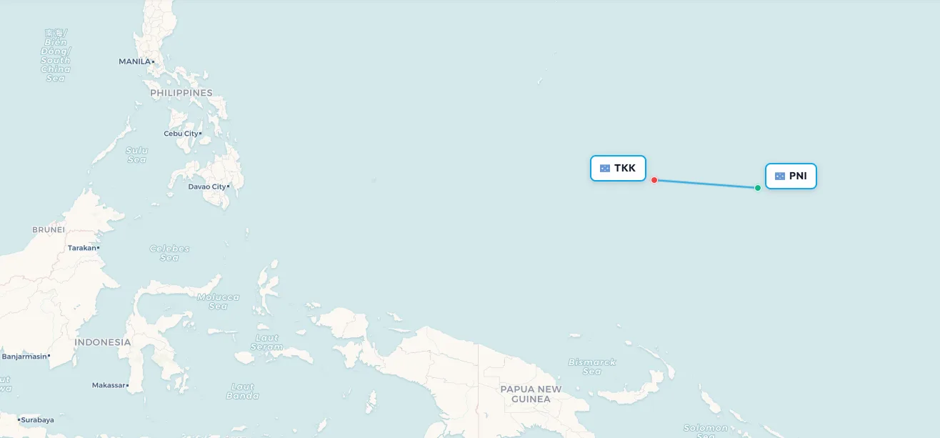
Search flights Kosrae → Pohnpei Search flights KSA → PNILeg 5: Pohnpei (PNI) → Chuuk (TKK)
Flight: UAL 154 | Distance: ~420 miles | Flight time: ~1 hour 14 minutes
Chuuk, formerly known as Truk, is ringed by a massive lagoon now recognised as one of the world's premier wreck-diving destinations. During Operation Hailstone in February 1944, US air and naval forces destroyed Japan's main South Pacific naval base in a single devastating two-day strike, sinking over 40 ships and destroying 270 aircraft. Those wrecks now rest between 10 and 60 metres below the surface, draped in coral and teeming with marine life. The 6,000-foot runway can develop gusty conditions in the afternoons, requiring autobrake 3 and careful energy management.
📥 Download route data (CSV) | 🗺️ Track this route in the app
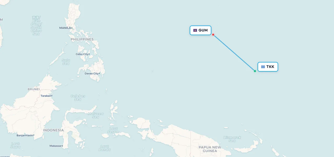
Search flights Pohnpei → Chuuk Search flights PNI → TKKLeg 6: Chuuk (TKK) → Guam (GUM)
Flight: UAL 154 | Distance: ~660 miles | Flight time: ~1 hour 41 minutes
The final stretch. After five landings, over a hundred cargo handoffs, and approximately 13 hours of total flying time, the Island Hopper descends into Antonio B. Won Pat International Airport on Guam. The ILS, the first precision approach since Honolulu, is a genuine relief to see. Guam's 10,000-foot runway feels positively luxurious after the short coral strips of the atolls. The pilots and crew who fly this rotation week after week are operating at the top of their craft: managing ETOPS requirements, remote-airfield procedures, unpredictable tropical weather, and tight turnarounds, all in the same working day.
📥 Download route data (CSV) | 🗺️ Track this route in the app
Search flights Chuuk → Agana Search flights TKK → GUMThe complete United Island Hopper route
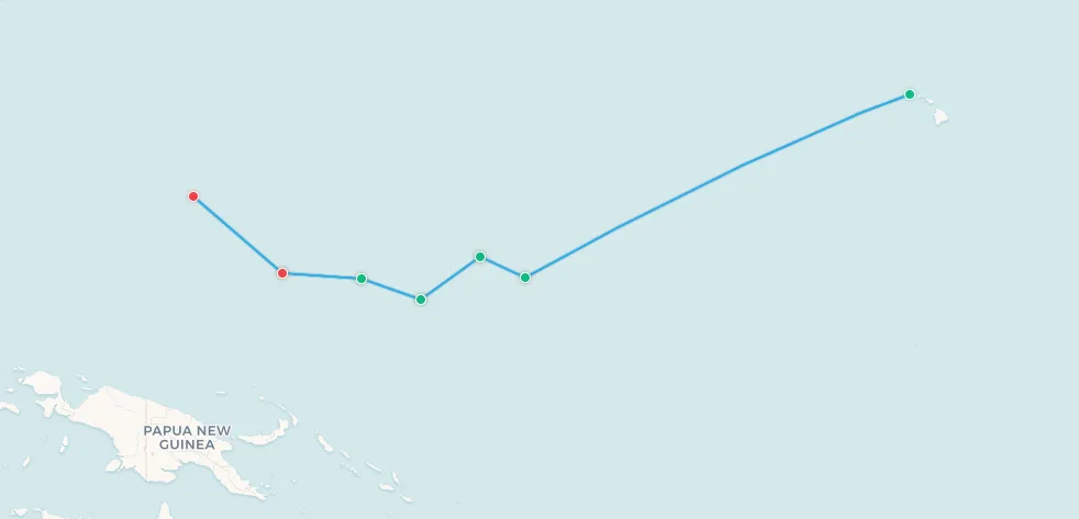
📥 Download full route data (CSV) | 🗺️ View full Island Hopper route on map
2. Nauru Airlines Australia-North Pacific Connector: the quiet lifeline
Far less famous than the United Island Hopper but no less vital is Nauru Airlines' weekly service connecting Brisbane to the central Pacific. Operated under Australia's Pacific Flights Program as the Australia-North Pacific Connector , this flight has been quietly sustaining air connectivity for some of the Pacific's smallest and most isolated nations for over 12 years.
Nauru Airlines is the national carrier of the Republic of Nauru , an island nation of just 21 km², the third-smallest country in the world, located roughly 4,000 km northeast of Australia. The airline operates a tiny fleet of just three Boeing 737 aircraft: a 737-300, a 737-700, and a 186-seat 737-800, all between 18 and 27 years old. That this carrier continues to provide an uninterrupted weekly service through the central Pacific is a remarkable feat of operational determination.
Source: AeroTime, Nauru Airlines hails renewal of Pacific Island hopper route for a further year , written by Luke Peters.
The route: Brisbane to Palau in five legs
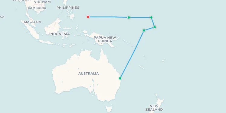
The weekly service departs Brisbane (BNE) and crosses approximately 9,000 km of the Pacific Ocean before arriving in Palau, touching down at five of the region's most remote and historically significant airports:
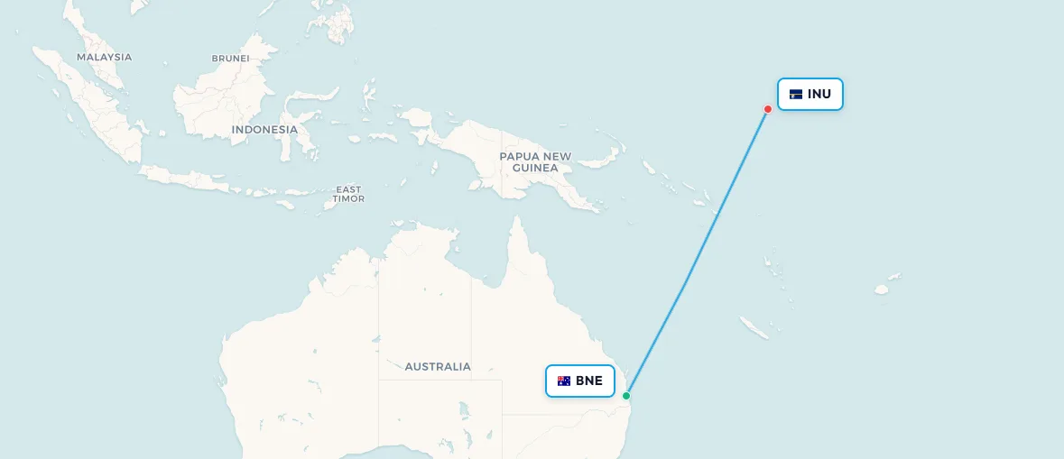
Leg 1: Brisbane (BNE) → Nauru (INU)
Airline: Nauru Airlines | Distance: ~3,300 km | Flight time: ~3 hours 40 minutes
The first leg is the longest of the journey, a sustained transoceanic crossing from the Australian east coast into the deep Pacific. As the 737 levels off, the Pacific opens up beneath with no islands, no ships, just open blue water until the distinctive oval silhouette of Nauru appears on the horizon. At just 21 km², Nauru is the world's smallest island nation, and its runway at Nauru International Airport sits almost at sea level, flanked by turquoise lagoon on one side and the open ocean on the other. This is the airline's home base, and the ground stop here is the only one where the aircraft is truly on home turf.
📥 Download route data (CSV) | 🗺️ Track this route in the app
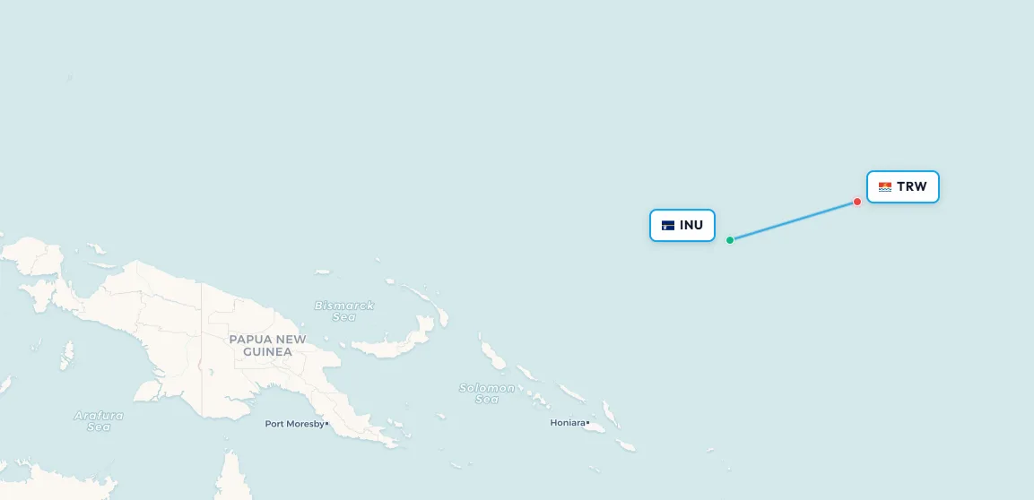
Search flights Brisbane → Nauru Search flights BNE → INULeg 2: Nauru (INU) → Tarawa (TRW)
Airline: Nauru Airlines | Distance: ~725 km | Flight time: ~1 hour
Tarawa is the capital of Kiribati, a nation that straddles three oceanic time zones and whose low-lying atolls make it one of the countries most acutely threatened by rising sea levels. South Tarawa's Bonriki International Airport sits on a strip of land barely wider than the runway itself, with the lagoon on one side and the open Pacific on the other. For many passengers boarding here, this weekly Nauru Airlines service is the most direct air link to the outside world.
📥 Download route data (CSV) | 🗺️ Track this route in the app
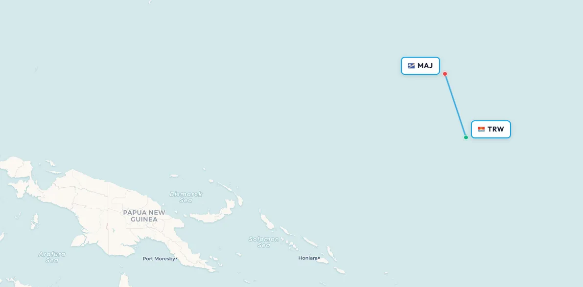
Search flights Nauru → Tarawa Search flights INU → TRWLeg 3: Tarawa (TRW) → Majuro (MAJ)
Airline: Nauru Airlines | Distance: ~660 km | Flight time: ~1 hour 5 minutes
Majuro also appears on the United Airlines Island Hopper route, making it one of just two airports in this part of the Pacific served by two separate island hopping services. As the capital of the Marshall Islands, it carries a particular weight of history: nuclear tests conducted on nearby Bikini and Enewetak atolls between 1946 and 1958 displaced thousands of Marshallese and left a legacy still felt today. For passengers boarding here bound for Brisbane, this may be their only practical air connection to Australia.
📥 Download route data (CSV) | 🗺️ Track this route in the app
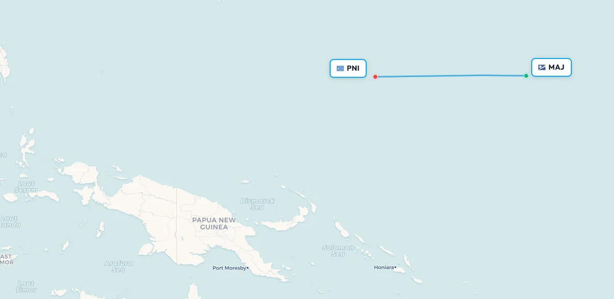
Search flights Tarawa → Majuro Search flights TRW → MAJLeg 4: Majuro (MAJ) → Pohnpei (PNI)
Airline: Nauru Airlines | Distance: ~1,500 km | Flight time: ~2 hours
Pohnpei also features on the United Island Hopper, making it one of the most connected airports in Micronesia despite its remote location. The island receives extraordinary rainfall and the approach into Pohnpei's single runway demands careful weather assessment. It is also home to the UNESCO-listed Nan Madol ruins, a series of stone islets built between AD 1200 and 1500, accessible by boat from the shore and often described as the Machu Picchu of the Pacific.
📥 Download route data (CSV) | 🗺️ Track this route in the app
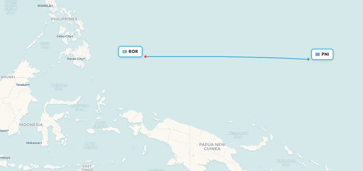
Search flights Majuro → Pohnpei Search flights MAJ → PNILeg 5: Pohnpei (PNI) → Palau (ROR)
Airline: Nauru Airlines | Distance: ~2,600 km | Flight time: ~3 hours 30 minutes
The newest stop on the route, Palau was added in December 2023 when the Australian government extended the service westward. Roman Tmetuchl International Airport serves a nation renowned worldwide for its marine biodiversity: Palau's Rock Islands, jellyfish lake, and protected marine sanctuary draw divers and naturalists from across the globe. For passengers aboard this weekly 737, touching down at ROR marks the end of a journey that began some 9,000 km earlier in Brisbane and crossed five of the Pacific's most storied island nations.
📥 Download route data (CSV) | 🗺️ Track this route in the app
Search flights Pohnpei → Babelthuap Search flights PNI → RORThe route was originally established over 12 years ago, suspended during the COVID-19 pandemic, and relaunched in October 2022 under its current branding. In November 2024, the Australian government renewed Nauru Airlines' contract for a further 12 months, ensuring continuity of what is, for several of these destinations, the only scheduled air service.
"Micronesia and the central and northern Pacific is Nauru Airline's home, and the airline has been connecting the Islands of the Pacific, and the people of the Pacific with Australia for over 53 years. Air services that connect Pacific Island countries with an important partner like Australia are crucial to the economic development of the region."
Brett Gebers, CEO of Nauru Airlines
The route is enabled by Australia's Pacific Partnerships for Aviation (P4A) program, a government initiative designed to support safer, more resilient, and sustainable aviation across the Pacific, improving people-to-people links and creating economic opportunities in a region where air connectivity is not a luxury but a prerequisite.
The complete Nauru Pacific Connector route
📥 Download full route data (CSV) | 🗺️ View full Nauru Pacific Connector route on map
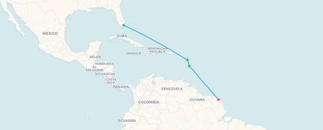
3. Air France Caribbean Island Hopper: the European surprise
Most people have never heard of a European carrier operating narrow-body flights out of Miami. And yet, twice a week, an Air France Airbus A320 departs Miami International Airport for a journey through the Caribbean and into South America, linking French overseas territories that are not just part of France but, legally, part of the European Union .
Air France operates this service with two dedicated A320s (registration codes F-HEPB and F-HEPC) permanently based in the Caribbean, the same type of aircraft you would typically find Air France operating on European routes such as Paris to London. It is one of the more remarkable operational anomalies in modern commercial aviation.
Source: Upgraded Points, 4 Things You Should Know About the Air France Island Hopper , written by James Larounis. The article includes detailed first-hand reporting on the on-board experience, immigration procedures at each stop, and meal service, highly recommended for anyone considering flying this route.
The route: Miami to South America via the Caribbean
The service operates on Fridays and Mondays and covers three legs over approximately 8 hours total:
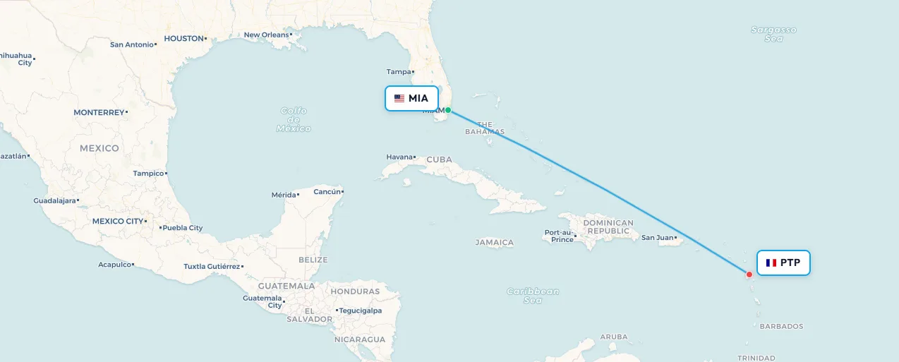
Leg 1: Miami (MIA) → Pointe-à-Pitre, Guadeloupe (PTP)
Aircraft: Airbus A320 | Flight time: ~3 hours 30 minutes
Guadeloupe is an overseas region and department of France in the Lesser Antilles, its twin-island shape responsible for its nickname, "the Butterfly Island." After landing at Pointe-à-Pitre International Airport, all passengers must exit the aircraft. Those continuing to Martinique or Cayenne must pass through passport control and a full security screening, reportedly thorough enough to surprise travellers accustomed to domestic-style transits. Once cleared, eligible passengers can use the Air France Lounge (compact but functional) before re-boarding as if originating from Guadeloupe.
📥 Download route data (CSV) | 🗺️ Track this route in the app
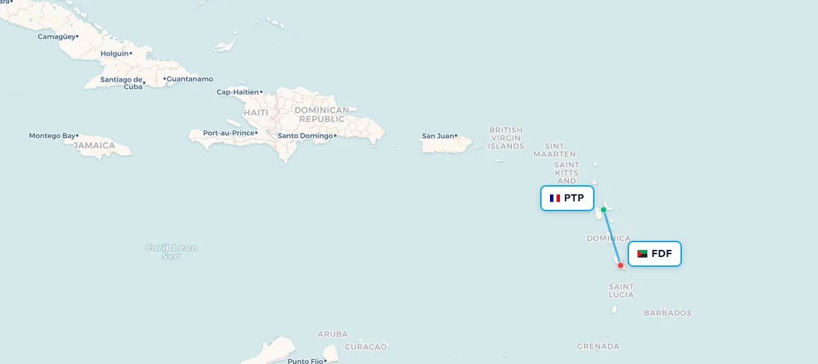
Search flights Miami → Pointe-a-pitre Search flights MIA → PTPLeg 2: Pointe-à-Pitre (PTP) → Fort-de-France, Martinique (FDF)
Aircraft: Airbus A320 | Flight time: ~20 minutes
One of the shortest legs flown by any mainline carrier, barely enough time for the trolley to reach the back of the cabin (though Air France reportedly manages a beverage run). Martinique, like Guadeloupe, is a French overseas department, its culture a vivid and electrifying blend of French and Caribbean influences. This leg is so short that passengers continuing to Cayenne simply stay on board during the approximately 20-minute ground stop while those disembarking at Fort-de-France head to immigration.
📥 Download route data (CSV) | 🗺️ Track this route in the app
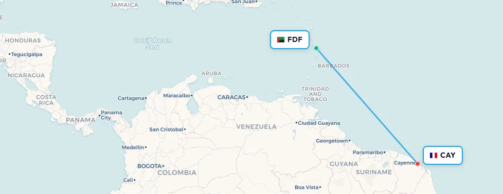
Search flights Pointe-a-pitre → Fort-de-france Search flights PTP → FDFLeg 3: Fort-de-France (FDF) → Cayenne, French Guiana (CAY)
Aircraft: Airbus A320 | Flight time: ~3 hours 30 minutes
French Guiana is not an island at all, it is a territory on the northeast coast of South America, a department of France, and an outermost region of the European Union. It is also home to the Guiana Space Centre , the primary launch facility for the Ariane rocket program and one of the most strategically important pieces of real estate on Earth. When passengers step off the Air France A320 at Félix Eboué Airport in Cayenne, they are technically entering the EU, in the tropics of South America. All passengers clear immigration here, with separate lanes for EU passport holders.
📥 Download route data (CSV) | 🗺️ Track this route in the app
Search flights Fort-de-france → Cayenne Search flights FDF → CAYThe complete Air France Caribbean Hopper route
📥 Download full route data (CSV) | 🗺️ View full Caribbean Hopper route on map
What to expect on board
The A320 is configured with 2 rows of European-style business class, economy seats with the middle seat blocked, plus approximately 168 economy seats in a 3×3 layout. Business class passengers receive lounge access at all four airports, complimentary checked luggage, priority boarding, and full meal service on the Miami–Guadeloupe and Martinique–Cayenne legs. Economy passengers receive complimentary beer and wine. Wi-Fi is available from €5 per segment, though connectivity may vary by aircraft. There are no seat-back screens on any leg, so bring your own entertainment, and pack a USB-C adapter, the on-board ports are USB-A only.
Three routes, three stories
What unites these three services, across three different oceans, three different airlines, and three vastly different operational contexts, is a single purpose: connection .
- The United Island Hopper is the heir to a 1960s aviation pioneer program. Week after week, a Boeing 737 threads through one of the last truly remote corners of the Earth, delivering mail, medicine, and provisions that would otherwise take weeks to arrive, and maintaining the thread that links the Marshall Islands and Micronesia to the wider world.
- The Nauru Airlines Pacific Connector is a quiet act of regional solidarity, funded by the Australian government and kept alive by a small island nation's determination to ensure the Pacific family stays connected. It is as much a diplomatic mission as a commercial one.
- The Air France Caribbean Hopper is the great anomaly: a European flag carrier deploying narrow-body jets from a US gateway to serve French citizens living in the Caribbean and on the coast of South America, a route that defies every conventional assumption about where European carriers operate.
All three island hopping routes on one map
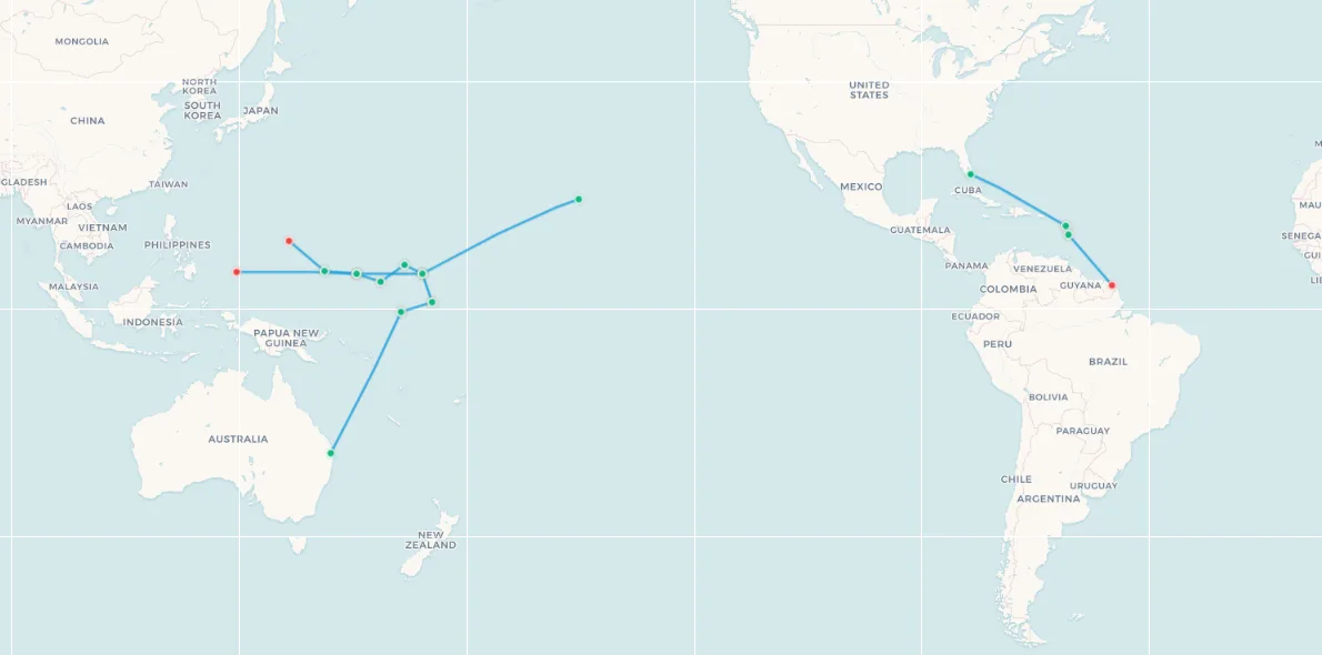
📥 Download all island hopping routes (CSV) | 🗺️ View all routes on interactive map
Frequently asked questions
Does United Airlines still fly the Island Hopper in 2026?
Yes. United Airlines Flight UA154 continues to operate daily between Honolulu (HNL) and Guam (GUM), making six intermediate stops at Majuro, Kwajalein, Kosrae, Pohnpei, and Chuuk. It remains the only commercial air service to Kwajalein and one of very few to the Marshall Islands and Federated States of Micronesia.
How many stops does the United Airlines Island Hopper make?
UA154 makes six intermediate stops: Majuro (MAJ) and Kwajalein (KWA) in the Marshall Islands, then Kosrae (KSA), Pohnpei (PNI), and Chuuk (TKK) in the Federated States of Micronesia, before reaching Guam (GUM). The full journey covers approximately 4,000 miles (6,400 km) and takes around 15 hours.
What airports does the Air France Caribbean Hopper serve?
The route connects Miami (MIA) with three French overseas territories: Pointe-à-Pitre in Guadeloupe (PTP), Fort-de-France in Martinique (FDF), and Cayenne in French Guiana (CAY). It operates twice weekly, on Fridays and Mondays, using an Airbus A320 permanently based in the Caribbean.
What is the Nauru Airlines Australia-North Pacific Connector?
It is a weekly service operated by Nauru Airlines (RN) between Brisbane (BNE) and Palau (ROR), stopping at Nauru (INU), Tarawa in Kiribati (TRW), Majuro in the Marshall Islands (MAJ), and Pohnpei in the FSM (PNI). Funded under Australia's Pacific Partnerships for Aviation (P4A) program, it serves as the primary air connection for several of the world's most isolated island nations.
Can you book just one leg of the United Airlines Island Hopper?
Yes. United Airlines sells individual legs of UA154 between any two stops on the route. You can book only Honolulu to Majuro, Pohnpei to Guam, or any other combination. Fares vary by leg and travel date.
Track your island hopping adventures
Have you flown any of these routes? Add them to My Flight Routes to map your Pacific crossings, Caribbean island hops, or South American connections, and see just how much of the world is reachable in a single, extraordinary flight.