When routes make no sense, until they do
There are more than 40,000 scheduled commercial airline routes operating around the world. The vast majority are predictable: city to city, hub to hub, the geography of business and tourism laid out in a sensible grid of lines on a route map. But scattered among those tens of thousands of routes are a handful that defy easy explanation, routes that exist for reasons of migration history, geopolitical necessity, military logistics, or sheer topographic challenge. These are the flights that make you stop and ask: why does this exist? How does this work? And, more often than not, who on earth is on this plane?
This list is not about the world's longest flights, although some routes here are very long. It is about flights that are unusual in their nature, strange in their existence, or unique in ways that have nothing to do with distance. A beach that serves as an airport. A runway that stops traffic on a national road. The world's highest commercial airport, where simply walking to your gate is a physiological challenge. A military aircraft that offers ten seats to civilians who must book by telephone. These ten routes represent the outer edges of what commercial aviation can be, the places where the network gets genuinely strange.
The 10 world's weirdest flights
| # | Route | Airline | Why it's weird |
|---|---|---|---|
| 1 | BRR → GLA | Loganair | Tidal beach runway - the only one in commercial aviation |
| 2 | GIB → LGW | easyJet / British Airways | Runway crosses a public road; traffic stops for every aircraft |
| 3 | LYR → OSL | Norwegian / SAS | World's most northerly scheduled jet service |
| 4 | GIG → LAD | TAAG Angola Airlines | South America's only direct link to sub-Saharan Africa |
| 5 | LUA → KTM | Tara Air / Summit Air | World's most dangerous commercial airport |
| 6 | BZZ → ASI → MPN | Royal Air Force | Military transport; ~10 civilian seats; telephone booking only |
| 7 | DCY → CTU | Sichuan / Tibet Airlines | World's highest commercial airport - 4,411 m (14,472 ft) |
| 8 | SFJ → CPH | Air Greenland | Crosses 3,350 km of the Greenland ice sheet |
| 9 | OAK → TER | Azores Airlines | 8,045 km, 1× weekly summer - Bay Area to mid-Atlantic Portugal |
| 10 | PVD → RAI | Cabo Verde Airlines | Weekly transatlantic from a mid-sized New England city |
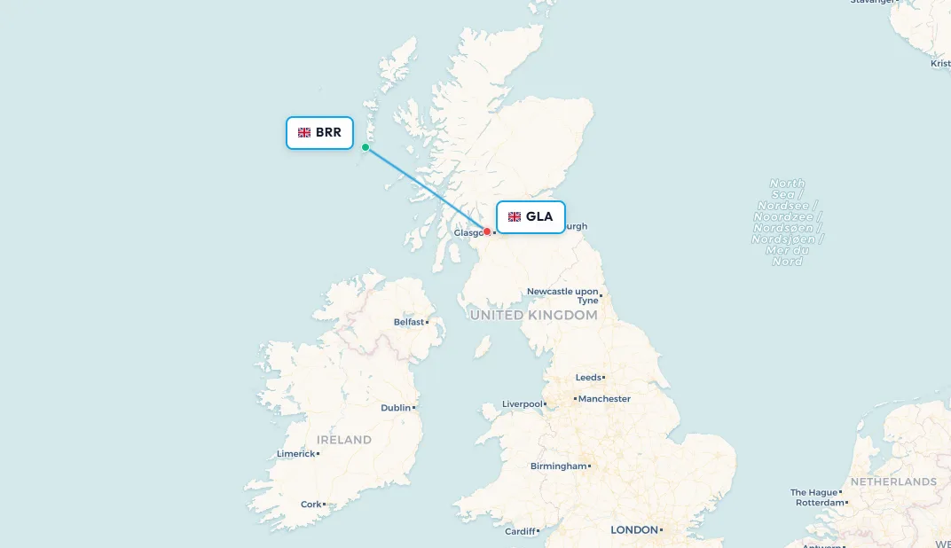
1. Barra (BRR) → Glasgow (GLA) - Scotland's tidal beach airport
Airline: Loganair
Aircraft: de Havilland Canada DHC-6 Twin Otter
Distance: ~220 km (137 miles)
Flight Time: ~25 minutes
Frequency: Multiple daily (tide-dependent)
Cockle Strand beach on the Isle of Barra, in the Outer Hebrides of Scotland, is the only place in the world where a scheduled commercial airline uses a tidal beach as its runway. At high tide, the strip is under water. At low tide, the firm, flat sand of Cockle Strand becomes a fully operational commercial runway, or rather three of them, marked by poles in the sand, pointing in different directions to accommodate the wind. Loganair publishes its flight schedule by consulting tide tables rather than allocating time slots, a process entirely without parallel in modern commercial aviation.
Loganair operates the service with a de Havilland Canada DHC-6 Twin Otter, one of the few production aircraft capable of the short-field, soft-surface performance that Cockle Strand demands. Sand, salt air and the occasional patch of seaweed are not standard runway materials; the Twin Otter's rugged construction means it copes where any conventional jet aircraft could not. The "terminal" is a modest building at one end of the beach, the airport has no lighting for night operations (there are no night operations, the tide comes in), and the check-in experience involves fresh Atlantic air and the sound of breaking waves. It is the most atmospheric airport on this list and possibly on Earth.
For Barra's roughly 1,100 residents, the Twin Otter service to Glasgow is essential connectivity. Without it, reaching the mainland requires a 5-hour Caledonian MacBrayne ferry to Oban, weather permitting. The flight exists because the community needs it; it operates because the beach allows it; and it appears on virtually every "world's most unusual airports" list because nothing else in scheduled commercial aviation resembles it. Passengers waiting for their aircraft on the sand, watching the twin-turboprop land on the beach, then boarding from the open air: it is the most genuinely strange boarding experience in aviation.
📥 Download route data (CSV) | 🗺️ Track this route in the app
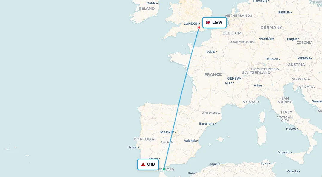
Search flights Barra → Glasgow Search flights BRR → GLA2. Gibraltar (GIB) → London Gatwick (LGW) - where aircraft stop the traffic
Airline: easyJet / British Airways (Heathrow)
Aircraft: Airbus A319 / A320
Distance: ~1,850 km (1,150 miles)
Flight Time: ~2 hours 30 minutes
Frequency: Multiple daily
Gibraltar Airport's runway crosses Winston Churchill Avenue, the main road connecting Gibraltar with the Spanish frontier, at its midpoint. Traffic lights halt cars, cyclists, motorcycles, and pedestrians whenever an aircraft needs to use the runway surface, whether taxiing, landing, or taking off. This arrangement exists nowhere else in the world in scheduled commercial aviation. When easyJet's morning Gatwick departure taxis out, rush-hour drivers simply wait. When the British Airways Heathrow service lands, anyone trying to drive from Spain into Gibraltar puts their car in park and watches through the windscreen. It is an accommodation Gibraltar has lived with since the airport was built in the 1930s, and one that has no realistic prospect of changing given the peninsula's geography.
The runway, 1,762 metres of tarmac, is challenging for reasons beyond the road crossing. The Rock of Gibraltar rises 426 metres of sheer limestone immediately adjacent to the eastern end of the strip, generating severe turbulence and unpredictable downdrafts on certain wind conditions. The approach from the Mediterranean is over open water; approach from the Spanish side threads through Spanish airspace over La Línea de la Concepción with the Rock forming an enormous natural obstacle off one wingtip. Crosswind components can be extreme, and landing videos from Gibraltar consistently circulate online due to the dramatic approach geometry and the visible proximity of the Rock through cockpit windows.
Despite the challenges, multiple airlines operate regular services to the territory: British Airways to Heathrow, easyJet to Gatwick and Bristol, Vueling to Barcelona, and Royal Air Maroc to Casablanca. The territory of 34,000 people is British by sovereignty and Spanish by geography, connected to the UK by the twice-daily BA widebody service and to the Spanish road network by the road that the aircraft keep interrupting. It is a small place with an outsize aviation story.
📥 Download route data (CSV) | 🗺️ Track this route in the app
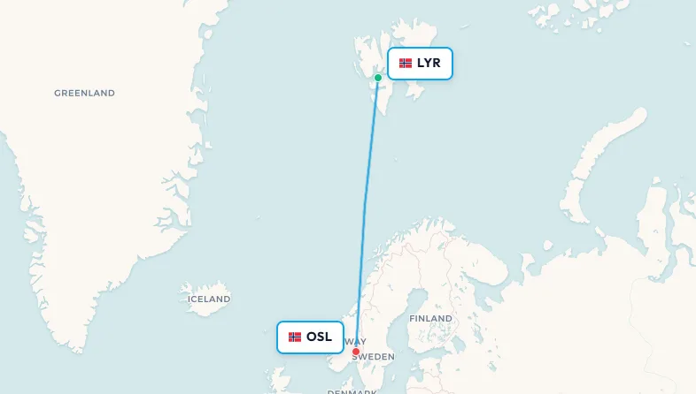
Search flights Gibraltar → London Search flights GIB → LGW3. Longyearbyen (LYR) → Oslo (OSL) - the world's most northerly jet service
Airline: Norwegian / SAS
Aircraft: Boeing 737-800 / 737 MAX 8
Distance: ~3,220 km (2,000 miles)
Flight Time: ~3 hours
Frequency: Multiple daily
Svalbard Airport sits at 78°13'N, closer to the North Pole (1,317 km away) than to Oslo (1,750 km to the south). It is the world's most northerly commercial airport with year-round scheduled jet service, connecting the town of Longyearbyen, one of the northernmost permanently inhabited settlements on Earth, to the Norwegian capital multiple times daily by Boeing 737. The town has roughly 2,400 inhabitants: researchers, miners, tourism workers, and their families, living in a former coal settlement at the edge of the habitable world.
What makes the LYR–OSL route genuinely peculiar is the legal framework underlying it. Under the Svalbard Treaty of 1920, citizens of any of the 46 signatory nations, which encompasses most of the world's populated countries, may live and work on Svalbard without a visa or residence permit. This creates Longyearbyen as a uniquely cosmopolitan Arctic settlement: Norwegians, Russians (operating the coal-mining settlement of Barentsburg, 90 km away), Thai hospitality workers, Ukrainian scientists, and dozens of other nationalities coexist in a community that is technically Norwegian territory but governed by a framework of international openness that predates most modern immigration systems. Norwegian and SAS sell seats on LYR–OSL as routinely as any domestic service, but the passport queue at Gardermoen contains nationalities from across the globe.
The extremes of polar light define the journey. From late October to mid-February, polar night means the sun does not rise above Svalbard's horizon for months, an aircraft landing at Longyearbyen in January arrives in total, sustained darkness, with the surrounding mountains visible only by their scattered lights. From late April to late August, the midnight sun means the sun never sets, a Boeing 737 arriving from Oslo at 11 pm lands in horizontal Arctic sunlight. Norwegian and SAS do not price this as an exotic adventure; it prices like any domestic Norwegian flight. The strangeness is entirely outside the window.
📥 Download route data (CSV) | 🗺️ Track this route in the app
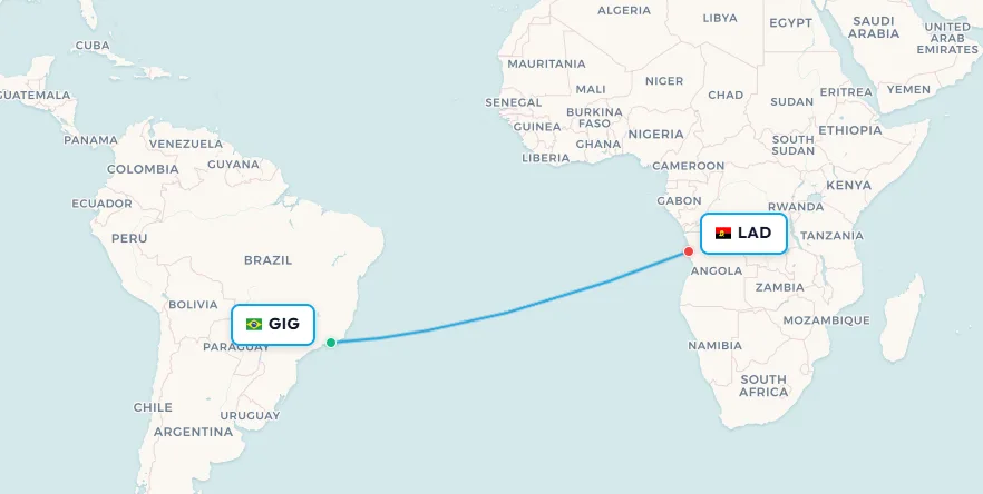
Search flights Svalbard → Oslo Search flights LYR → OSL4. Rio de Janeiro (GIG) → Luanda, Angola (LAD) - South America's only direct link to sub-Saharan Africa
Airline: TAAG Angola Airlines
Aircraft: Boeing 777-300ER
Distance: ~6,200 km (3,850 miles)
Flight Time: ~10 hours 55 minutes
Frequency: Several times weekly, year-round
Most transatlantic routes connect Europe to the Americas. Direct routes between South America and Africa are extraordinarily rare, and for the most historically logical reason: the Atlantic slave trade created demographic and cultural connections between these two continents that persist 200 years after abolition, yet commercial aviation largely ignored those connections. There are almost no direct flights between them. TAAG Angola Airlines' service between Rio de Janeiro Galeão and Luanda's Quatro de Fevereiro International Airport is one of the very few that exists, and the context for why it exists is unlike almost any other route in the world.
The link between Brazil and Angola is deep and specific. Both countries are Portuguese-speaking, a legacy of the same colonial power that operated the slave trade between them. Angola was the single largest source of enslaved people transported to Brazil during the transatlantic slave trade; the cultural, genetic, and linguistic ties between the two countries remain visible in Bahia, in Afro-Brazilian religious practice, in music, and in cuisine. Angola's oil economy and Brazil's engineering and construction industries have created modern business connections. TAAG's 777-300ER crosses this history in under 11 hours, carrying business travellers, the Brazilian diaspora in Angola, Angolans studying in Brazil, and the occasional aviation enthusiast who has realised what this route represents.
From Rio, no other direct flight reaches sub-Saharan Africa. The TAAG service is the only option for a direct South Atlantic crossing from Brazil's largest city to the African continent. The alternative is routing through Lisbon, Addis Ababa, or Dubai, which adds hours or an entire day. For a pair of countries with centuries of documented connection, the relative scarcity of aviation capacity between them says something uncomfortable about where airline networks direct their attention. The 11-hour crossing exists; it is simply one of aviation's better-kept secrets.
📥 Download route data (CSV) | 🗺️ Track this route in the app
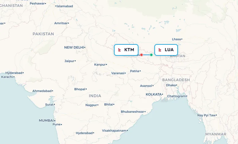
Search flights Rio De Janeiro → Luanda Search flights GIG → LAD5. Lukla (LUA) → Kathmandu (KTM) - the world's most dangerous airport
Airline: Tara Air / Summit Air
Aircraft: de Havilland Canada DHC-6 Twin Otter / Let L-410 Turbolet
Distance: ~140 km (87 miles)
Flight Time: ~30 minutes
Frequency: Multiple daily (weather permitting, morning only)
Tenzing-Hillary Airport at Lukla, Nepal, named for the first two climbers to summit Everest, holds a distinction no airport wants: it appears on virtually every "world's most dangerous airports" list and has been involved in a series of fatal accidents across its operational history. The statistics explain why. The runway sits at 2,845 metres (9,334 feet) elevation, is just 527 metres long, and runs at an 11.7% uphill gradient toward the Himalayan face. The lower end drops off a cliff into the gorge of the Dudh Koshi river hundreds of metres below. There is no instrument approach, pilots must see the runway to land. If they cannot see it, they return to Kathmandu. If a landing goes wrong, there is no go-around: the terrain immediately above the runway threshold makes a missed approach effectively impossible.
The airport exists because Lukla is the gateway to Everest Base Camp and the Khumbu region. Approximately 50,000 trekkers per year begin their Everest journey here; without the flights, the approach to Lukla on foot from the nearest road-accessible point takes eight to twelve days each way. Tara Air operates DHC-6 Twin Otters; Summit Air operates Let L-410 Turbolets. These aircraft carry trekkers, porters, oxygen cylinders, and food supplies in quantities that would otherwise require multi-week mule trains. The 30-minute flight from Kathmandu's Tribhuvan International Airport is spectacularly scenic, Himalayan ridges, ice-draped peaks, and valleys that drop thousands of metres outside the windows, and spectacularly unforgiving of error.
The operational rhythm at Lukla is dictated by mountain weather. Flights operate from dawn until roughly midday; afternoon cloud build-up and turbulence make safe operations impractical. When morning fog fills the valley, the airport can close for days. Passengers waiting for flights after a closure can number in the hundreds: trekkers who have missed international connections, expedition members with fixed departure windows, porters needing to return for their next job. The safety record has improved significantly with better crew training and revised procedures, but the fundamental physics of the airport, a 527-metre strip ending in a cliff, one-way approach, terrain on all sides, cannot be changed. It is what it is, and what it is, is genuinely strange.
📥 Download route data (CSV) | 🗺️ Track this route in the app
Search flights Lukla → Kathmandu Search flights LUA → KTM6. RAF Brize Norton (BZZ) → Ascension Island (ASI) → Falkland Islands (MPN) - 10 civilian seats on a military jet
Operator: Royal Air Force
Aircraft: Airbus A330 Voyager (military transport)
Distance: BZZ→ASI: ~6,800 km (4,225 miles) | ASI→MPN: ~6,300 km (3,915 miles)
Flight Time: ~9 hours + ~8 hours 45 minutes
Frequency: Up to 3× weekly
Most unusual flights on this list can be booked online. This one cannot. The RAF service from Brize Norton in Oxfordshire to the Falkland Islands allocates approximately ten civilian seats per departure, and securing one requires contacting the Falkland Islands Government Office in London, 35 Great Queen Street, WC2B 5HA, by telephone or email. There is no airline code, no online booking engine, no seat map. You contact the government office, provide your details, and receive confirmation if space is available. The aircraft is a military Airbus A330 Voyager, configured for troop and cargo transport, with seating that is serviceable rather than comfortable and inflight service that is minimal rather than curated. It is, in the most literal sense, a seat on a military transport flight.
The route stops at Ascension Island, an isolated volcanic peak in the mid-South Atlantic. Ascension hosts a joint British-American military facility, a BBC World Service relay transmitter, a NASA tracking station, and a population of under 1,000, consisting almost entirely of military personnel and civilian staff on rotation. There is no scheduled commercial airline service to Ascension; the RAF flight is one of the very few ways to visit legitimately. Some of the ten civilian seats allocated to the Brize Norton departure belong to Ascension Island residents and government staff rotating in and out, meaning the same flight connects two of the most remote communities in the British sphere.
From Ascension, the Voyager continues south for nearly nine more hours to RAF Mount Pleasant Airport on East Falkland, a military installation built after the 1982 Falklands War that serves as the primary air gateway for an island of approximately 3,400 British citizens living 13,000 km from London. From Mount Pleasant, the weekly LATAM/DAP service to Punta Arenas in Chile provides the only alternative route off the islands. The RAF flight is the Falklands' umbilical to the United Kingdom, operating on a military schedule and a government booking process that places it in a category entirely of its own in commercial, or rather semi-commercial, aviation.
📥 Download route data (CSV) | 🗺️ Track this route in the app
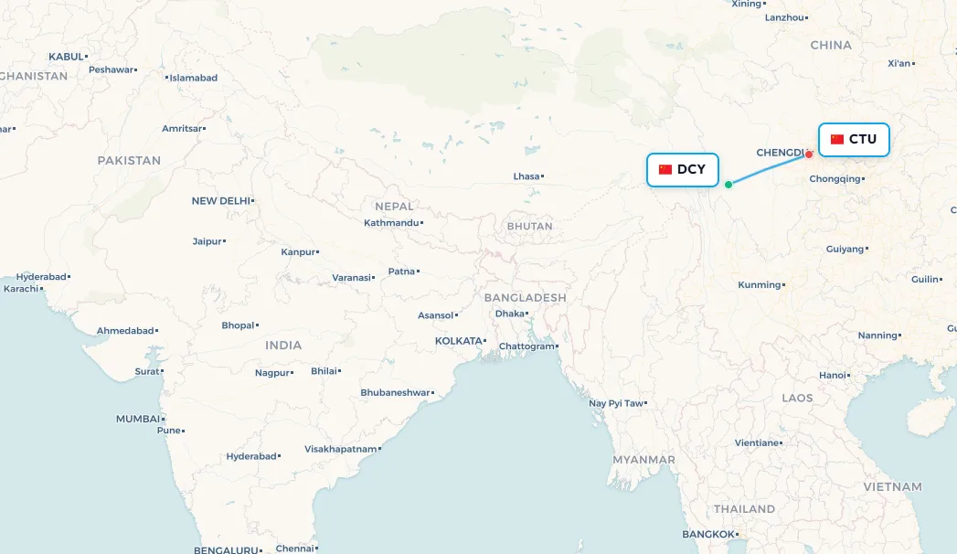
Search flights Brize Norton → Mount Pleasant Search flights BZZ → MPN7. Daocheng Yading (DCY) → Chengdu (CTU) - boarding at the top of the world
Airline: Sichuan Airlines / Tibet Airlines
Aircraft: Boeing 737-800
Distance: ~1,150 km (715 miles)
Flight Time: ~1 hour 30 minutes
Frequency: Several weekly
Daocheng Yading Airport in Sichuan Province, China, holds the title of world's highest commercial airport by elevation. Opened in 2013, it sits at 4,411 metres (14,472 feet) above sea level, higher than the Matterhorn's summit, higher than the base camps of most Himalayan expeditions, and high enough that walking briskly between the terminal and the departure gate is a physiological challenge. Oxygen levels at the airport are roughly 60% of sea-level values. Airport staff work reduced hours due to the altitude. Passengers are advised to move slowly and avoid sudden exertion. The thin air affects everyone regardless of fitness level or prior acclimatisation.
The runway at Daocheng Yading stretches 4,200 metres, one of the longest in China, not because the route demands it aerodynamically, but because the drastically reduced air density at 4,411 metres substantially diminishes both engine thrust and aerodynamic lift, requiring dramatically longer takeoff and landing rolls. Sichuan Airlines and Tibet Airlines operate Boeing 737-800s on the route; pilots hold specific type certifications for high-altitude plateau operations and are trained in the meteorological and physiological characteristics of extreme-altitude flying. The passenger experience of boarding a standard Boeing narrowbody, the same aircraft type connecting Chicago to Atlanta or London to Barcelona, in conditions where simply standing up from a chair causes light-headedness, is genuinely disorienting.
The airport serves the Daocheng Yading Nature Reserve, a UNESCO-recognised landscape of glaciated peaks, turquoise alpine lakes, and ancient Tibetan Buddhist monasteries, considered one of China's most spectacular natural environments. Before the airport opened, reaching Yading required two to three days of mountain driving from Chengdu along roads that test both vehicles and passengers. Today a Sichuan Airlines 737 covers the distance in 90 minutes. You land, the doors open, and the altitude hits you before you even rise from your seat. No other scheduled route in the world offers quite this arrival experience.
📥 Download route data (CSV) | 🗺️ Track this route in the app
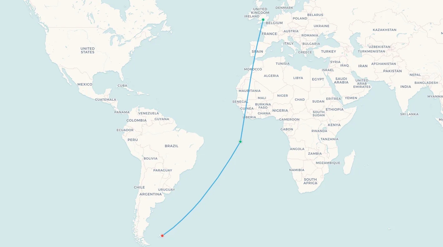
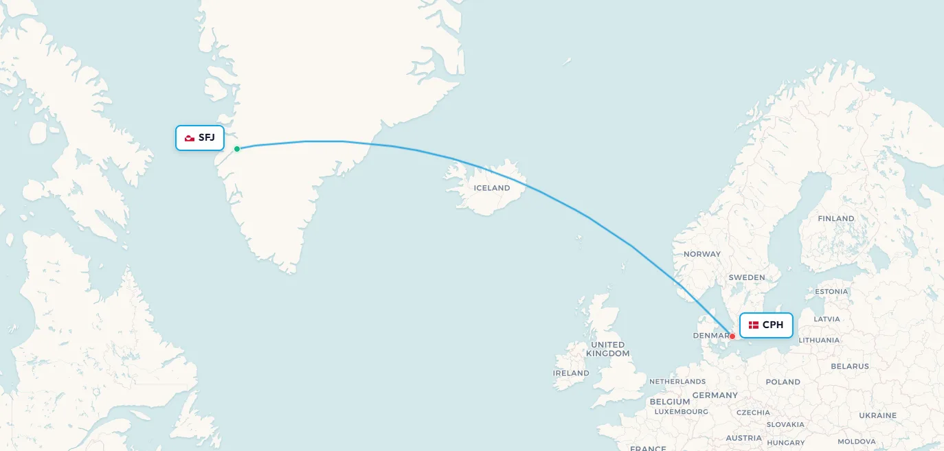
Search flights Daocheng → Chengdu Search flights DCY → CTU8. Kangerlussuaq (SFJ) → Copenhagen (CPH) - across the Greenland ice sheet
Airline: Air Greenland
Aircraft: Airbus A330-800neo
Distance: ~3,350 km (2,083 miles)
Flight Time: ~4 hours 30 minutes
Frequency: Several weekly
Kangerlussuaq is not a city. It is a settlement of approximately 500 people at the head of one of Greenland's longest fjords, existing primarily because of its airport. The runway, 3,048 metres of concrete extending across a glacial outwash plain, was built in 1941 by the United States Army Air Forces under the codename Bluie West Eight, constructed as a strategic refuelling stop for aircraft crossing between North America and Europe during the Second World War. After the war, the Americans retained the base until 1992, when it was transferred to Greenlandic control. It is now Greenland's main international hub: the airport most visitors to the world's largest island will pass through when flying from Europe.
Air Greenland's Airbus A330-800neo, the most advanced aircraft in the world's most northerly widebody fleet, operates the Copenhagen service, crossing approximately 3,350 km of ice, ocean, and subarctic air. The view from the cabin on the outbound leg from Copenhagen is one of the most extraordinary available in scheduled commercial aviation: the Labrador Sea gives way to Greenland's southern coast, then the landscape transforms entirely into the ice sheet, 1.7 million square kilometres of glacial ice, up to 3 kilometres thick, covering 80% of the island and visible from altitude as a featureless white horizon broken only by the occasional dark nunatak projecting above the surface. The descent into Kangerlussuaq follows the fjord, between walls of rock, onto the flat Arctic plain.
The airport's operational peculiarity is its position as the hub of a network with no road connections to anywhere. Kangerlussuaq has no road to any other Greenlandic settlement; in winter, snowmobiles provide overland access to nearby communities, but connectivity to Nuuk (the capital), Ilulissat (famous for its UNESCO icefjord), and Sisimiut is entirely by Air Greenland's domestic network. Musk oxen occasionally wander close to the runway. The airline does not advertise this as a wildlife experience. It simply is one.
📥 Download route data (CSV) | 🗺️ Track this route in the app
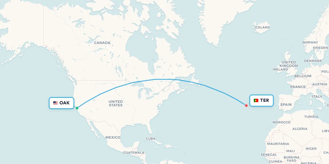
Search flights Sondrestrom → Copenhagen Search flights SFJ → CPH9. Oakland (OAK) → Terceira, Azores (TER) - the Bay Area's mid-Atlantic shortcut
Airline: Azores Airlines (SATA International)
Aircraft: Airbus A321XLR
Distance: ~8,045 km (5,000 miles)
Flight Time: ~9 hours 25 minutes
Frequency: Seasonal (summer), 1× weekly
The Azores, nine volcanic Portuguese islands in the mid-Atlantic, roughly equidistant between Europe and North America, have a well-documented connection to California stretching back to the early 19th century. Azorean whalers began arriving in the Bay Area in the 1820s, drawn by Pacific whaling waters. Subsequent waves of migration in the early 1900s, driven by poverty and natural disasters (the islands are seismically and volcanically active), planted Azorean-American communities across the East Bay and the Central Valley. Today, an estimated 250,000 people of Azorean descent live in California, one of the largest Azorean diaspora populations in the world.
Azores Airlines operates its summer service from Oakland International Airport, on the east side of San Francisco Bay, to Lajes Airport on Terceira Island, a runway originally built by the US Army Air Forces in 1943 as a transatlantic staging post for aircraft heading to the European theatre. From Terceira, connections to the other eight islands are available via Azores Airlines' inter-island network, making OAK a realistic gateway to the entire archipelago. The flight covers approximately 8,000 km of open Atlantic, crossing from the Pacific coast of the United States to an island group that belongs to continental Europe yet sits closer to New York than to Lisbon.
Terceira itself contains Angra do Heroísmo, a UNESCO World Heritage City whose 15th-century fortifications and Renaissance architecture are extraordinarily intact. The island served for centuries as a critical waypoint in transatlantic trade during the Age of Discovery, Portuguese spice ships returning from Asia would stop here before the final leg to Lisbon. Today, a weekly Azores Airlines Airbus makes landfall on the same island, 9.5 hours after departing California, for reasons that have more to do with 19th-century whale hunting than any revenue manager would design from scratch. The route exists because a community does. That is sufficient.
📥 Download route data (CSV) | 🗺️ Track this route in the app
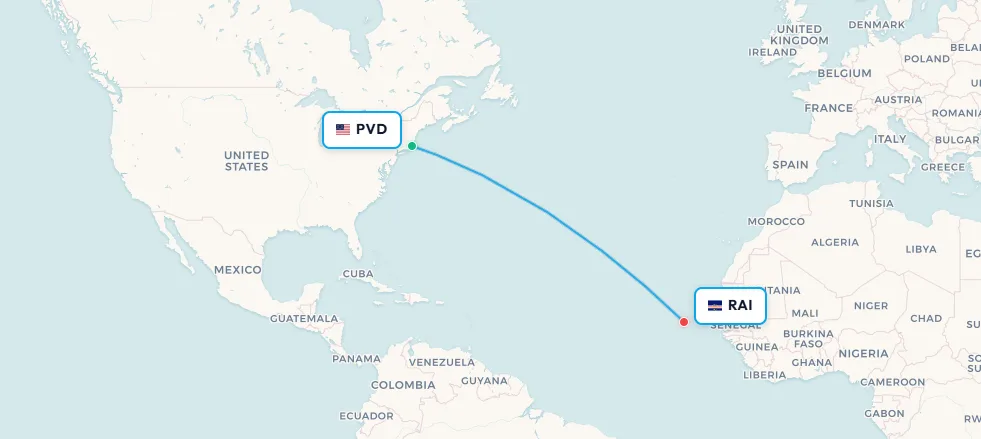
Search flights Oakland → Lajes (Terceira Island) Search flights OAK → TER10. Providence (PVD) → Praia, Cape Verde (RAI) - two centuries of diaspora, one weekly flight
Airline: Cabo Verde Airlines (TACV)
Aircraft: Boeing 757-200
Distance: ~5,470 km (3,400 miles)
Flight Time: ~8 hours
Frequency: 1× weekly, year-round
Providence, Rhode Island has a population of roughly 190,000, a mid-sized regional airport handling under a million passengers a year, and a weekly nonstop flight to an island nation 5,470 km off the coast of West Africa. The explanation is migration history stretching back two centuries. Cape Verdean sailors began arriving in New Bedford, Massachusetts, in the 1820s aboard American whaling vessels. The whaling industry needed crews for increasingly distant and dangerous voyages; Cape Verde supplied men willing to take them. By the early 20th century, Cape Verdean immigration had established communities across southeastern Massachusetts and Rhode Island that today number approximately 90,000 people in New England, one of the largest Cape Verdean diaspora populations outside the islands themselves.
Cabo Verde Airlines operates its Boeing 757-200 once weekly from T.F. Green Airport in Providence to Nelson Mandela International Airport in Praia, the Cape Verdean capital on Santiago Island. The economics rest almost entirely on the diaspora: there is no significant non-Cape Verdean tourism market that would sustain a weekly transatlantic service from a mid-sized New England airport to a small island nation. The passengers on this flight are families visiting relatives in Fogo, Santiago, and São Vicente; Cape Verdean-Americans attending weddings, funerals, and baptisms; and the occasional traveller who has discovered Cape Verde through serendipity. The flight exists because a community that arrived on whaling ships 200 years ago has never lost its connection to a cluster of Atlantic islands.
Cape Verde itself is one of the genuinely overlooked destinations in the Atlantic. The ten islands of the archipelago, each with a distinct character, landscape, and creole dialect, offer Saharan dunes on Boa Vista and Sal, volcanic peaks on Fogo still smoking from the 2014 eruption, Carnival celebrations second only to Brazil's, and a West African–Portuguese cultural blend found nowhere else on Earth. The Providence route, for visitors willing to discover it, offers transatlantic access without the detour through Lisbon or Amsterdam. It is one of aviation's quieter secrets: a weekly flight sustained entirely by history and family, serving a destination that deserves far more attention than it typically receives.
📥 Download route data (CSV) | 🗺️ Track this route in the app
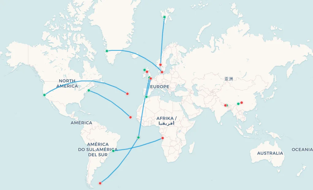
Search flights Providence → Praia, Santiago Island Search flights PVD → RAIAll 10 routes on one map
📥 Download all routes data (CSV) | 🗺️ Explore all routes in the app
What makes a flight weird?
These ten routes share almost nothing in their physical characteristics. One lasts 25 minutes; another nearly 11 hours. One uses a tidal beach; another uses a military aircraft. One requires booking by telephone with a government office; another sells out on a standard low-cost booking engine. What they share is something harder to quantify: each exists for a reason that a purely rational airline network planner would never generate. They exist because of migration patterns that predate aviation, geopolitical arrangements that predate most modern nations, geography that defeats conventional airport design, or bureaucratic frameworks that force routes into improbable shapes.
The commercial aviation system, for all its optimisation and efficiency, cannot eliminate the messy human reasons that generate these routes. Communities need connections. Governments have obligations. History creates demand. The result is a global route map that, if you look closely enough, contains dozens of surprises, flights connecting places no algorithm would ever pair, operated by aircraft that shouldn't fit the airports, booked by passengers whose reasons for travelling belong to stories far older than the airlines that carry them. These ten are the ones that made this list. But the strange routes are far from exhausted.
Frequently asked questions
What is the world's weirdest commercial flight route?
The Barra to Glasgow service (BRR–GLA) operated by Loganair is widely considered the world's strangest scheduled commercial flight. It uses Cockle Strand tidal beach on the Isle of Barra as its runway, the only scheduled airline in the world to land on a beach. Flights are timetabled around the tide rather than fixed time slots.
How do you fly to the Falkland Islands?
The primary air link is the RAF service from Brize Norton (BZZ) via Ascension Island (ASI) to RAF Mount Pleasant Airport (MPN) on East Falkland, with approximately ten civilian seats per flight. Booking requires contacting the Falkland Islands Government Office in London (35 Great Queen Street, WC2B 5HA) by telephone or email. A separate weekly LATAM/DAP service connects Mount Pleasant to Punta Arenas, Chile.
What is the world's highest commercial airport?
Daocheng Yading Airport (DCY) in Sichuan Province, China, at 4,411 metres (14,472 feet) above sea level. Sichuan Airlines and Tibet Airlines operate Boeing 737-800 flights between Daocheng Yading and Chengdu (CTU). The runway is 4,200 metres long to compensate for reduced air density and lift at extreme altitude.
What is the world's most dangerous airport for commercial flights?
Tenzing-Hillary Airport at Lukla, Nepal (LUA). Its 527-metre runway sits at 2,845 metres elevation, runs uphill at an 11.7% gradient toward the Himalayan face, and has a sheer cliff drop at the lower end. There are no instrument approaches and no go-around option. Tara Air and Summit Air operate DHC-6 Twin Otter and Let L-410 Turbolet aircraft on the Lukla–Kathmandu route.
Is there a direct flight between South America and Africa?
Yes. TAAG Angola Airlines operates a year-round service between Rio de Janeiro Galeão (GIG) and Luanda (LAD) using a Boeing 777-300ER, covering approximately 6,200 km across the South Atlantic. It is one of the very few direct flights between South America and sub-Saharan Africa.
What is the most northerly commercial airport with regular jet service?
Svalbard Airport Longyearbyen (LYR) at 78°13'N in the Norwegian High Arctic, closer to the North Pole than to Oslo. Norwegian and SAS operate Boeing 737-800 and 737 MAX 8 flights year-round between Longyearbyen and Oslo, connecting an Arctic community of approximately 2,400 people.
Track these routes in the app
Download any of the CSV files above to import individual routes or the complete collection into your My Flight Routes map. Each CSV contains the airport codes, distance, and flight time data you need to visualise these routes on the global map and log them in your personal flight history. Whether you are a route enthusiast, a flight completionist, or simply someone who likes knowing that a military jet to the Falkland Islands via Ascension Island is a technically bookable option, these routes are worth adding to your collection.