Your Year in Flights, Ready to Share
A year of flying deserves more than a row in a table. Pick a year, and your flights become a story: how many times you took off, how far you went in laps of the Earth, the countries you set foot in for the first time, the airports and routes you kept coming back to, the whole year replaying on a map, and at the end a recap image made to be shared. It is free, it works with the flights you have already logged, and you do not need an account.
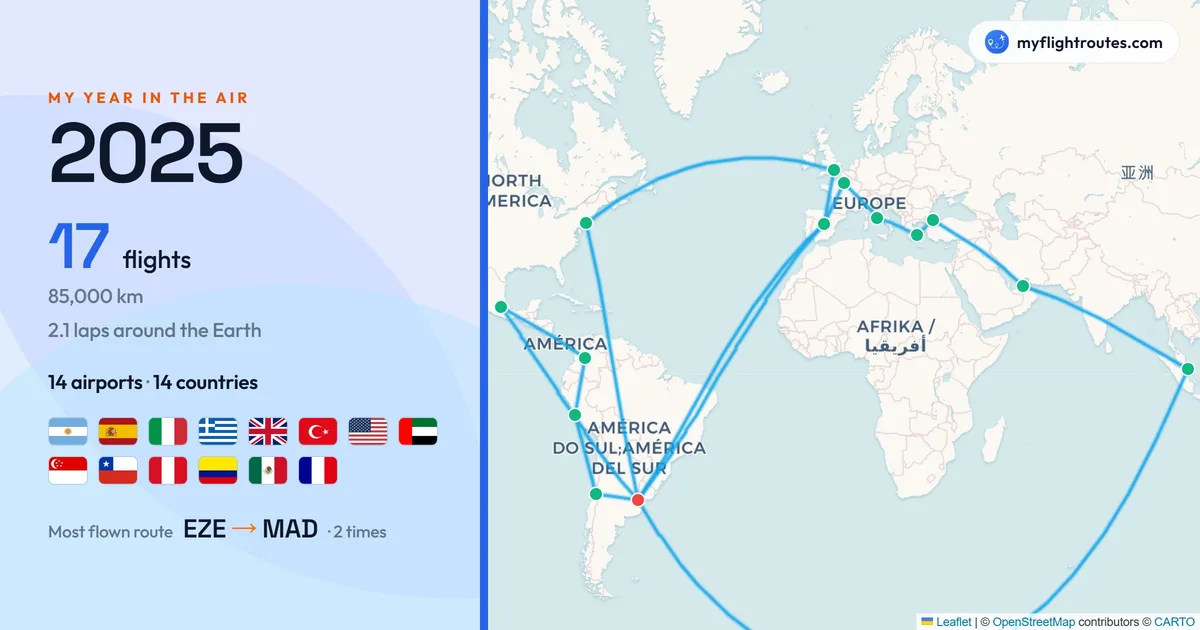
The recap: the year's routes on a map, the distance in laps of the Earth, every country as a flag, and the route you flew most.
What a Year in Review Shows You
A map of a year shows where you went. The review tells you what that year was like:
- Your numbers: Flights, distance, hours in the air, airports and countries, each compared with the year before
- Distance you can picture: Kilometres turned into laps around the Earth, or the share of one lap for a quieter year
- New places: The countries and airports you reached for the first time that year
- Your favourites: The airports you passed through most, the route you flew most often, the airline you flew most
- Extremes: Your longest and shortest flights, and the one that cost you the most sleep to jet lag
- Rhythm: Your busiest month, and your first and last flights of the year
- Milestones: The badges you unlocked and the traveller tier you reached during the year
How the Story Is Told
The review is a full-screen sequence of slides, one beat at a time:
- One reveal per slide: A single number or a single fact at a time, counting up as it appears
- The year replayed: Your flights drawn on a map in the order you took them, with the camera following the journey
- It moves on its own: Slides advance by themselves; press and hold to pause, tap to go back or skip ahead
- Only what applies: A year with two flights is a short story; slides with nothing to say are left out rather than shown empty
- Every year you have flown: Switch years on the first slide; the current year opens on 1 December
- Light and dark: The story and the recap image follow your theme
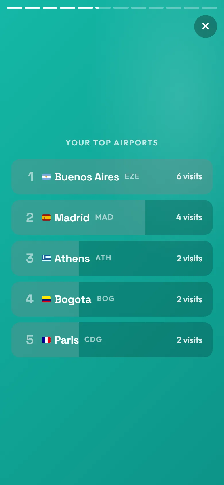
One slide, one fact: the airports you passed through most, ranked.
How to Make Your Year in Review
- Add your flights: Type them in, click them off the map, or import a spreadsheet. Dated flights are what the review works from.
- Open Year in Review: From the Stats page or the menu. Guests can use it too; your flights stay in your browser.
- Pick a year: Any past year with flights is ready now. The current year unlocks on 1 December, once it is nearly complete.
- Watch the story: Tap through or let it run; the replay in the middle plays your year on the map.
- Post the recap: The last slide is an image sized for stories or for a wide post. Download it, copy it, or share it straight to an app.
Who Makes a Year in Review?
Anyone with a year worth looking back on:
- Frequent flyers who want a year of work travel summed up in a minute
- Travellers marking a big year: a gap year, a move abroad, a round the world trip
- Anyone who collects countries and wants the year's new flags in one picture
- Aviation enthusiasts comparing this year's numbers with last year's
- Anyone who posts a year-end recap and wants one for their flights too
A Recap Made for Posting
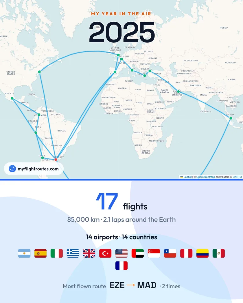
The review ends on a recap image: the year's routes drawn on a map, the distance flown in laps of the Earth, your flights, airports and countries, every country as a flag, and the route you flew most (or your longest flight). It comes in a vertical format for stories and a wide one for feeds and chats, in your light or dark theme. Download it, copy it, or share it directly from your phone. Nothing else is published: the story itself stays yours.
Frequently Asked Questions
Is the year in review free?
Yes. It is part of My Flight Routes and free, with or without an account. Guests' flights are stored in the browser; an account keeps them across devices.
When does the current year become available?
On 1 December. Before that, the review offers every past year with flights; the current year appears as soon as December begins, so the numbers are nearly final.
Do my flights need dates?
Yes. The review is built from dated flights, because a flight without a date belongs to no year. Undated flights are left out, and the first slide tells you how many.
Can I share the whole story?
The story is for you; what you share is the recap image at the end. It is a single picture that carries the year: the map, the numbers, the flags and your most flown route.
How is distance turned into laps of the Earth?
Your total distance is divided by the Earth's circumference at the equator, about 40,075 km. A year under one lap shows the share of a lap instead.
Does it work on a phone?
Yes, it is designed for one. Tap the right side to move on, the left to go back, or swipe; press and hold to pause. On a phone the recap image defaults to the vertical format.
Your flights already know what kind of year it was. Let them tell it.