A Colour-Coded Map of Every Flight You Have Taken
A map of your flights shows where you have been. Colour it, and it starts telling you how. Map modes recolour the same routes to answer a different question each time: which years took you where, whether you are a red-eye flyer, which airline you really fly the most, how far your trips reach, which countries you keep going back to and which airports are your real home base. Switch between them with one tap, right on the map. It is free, it works with the flights you have already logged, and you do not need an account.
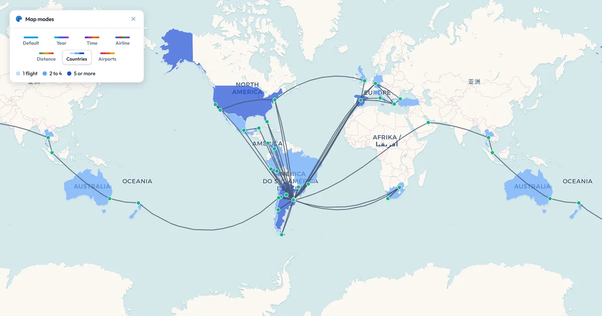
Countries mode: every country you have flown to, shaded by how often you went, under your routes.
Seven Ways to See the Same Flights
Each mode keeps your routes exactly where they are and changes what their colour means:
- By year: Your oldest flights in cyan, your newest in magenta, and every year in between on the way. Filter the map to a few years and the colours spread across just those
- Time of day: Night, dawn, day and evening departures in their own colours, from the departure times on your flights. Red-eyes stand out at a glance
- By airline: Your six most flown airlines each get a colour, named in the key, and the rest share one grey. Two airlines behind one code are kept apart
- By distance: Your shortest route at one end of the scale and your longest at the other, so a map of long-haul trips still shows which were the long ones
- Countries: Every country you have flown to or from, shaded by how many of your flights touched it, with your routes quiet on top
- Airport glow: A glow on every airport you have used, bigger and warmer the more flights went through it. Your hubs light up
- Default: Your routes in their own colours, custom and tag colours included, exactly as before
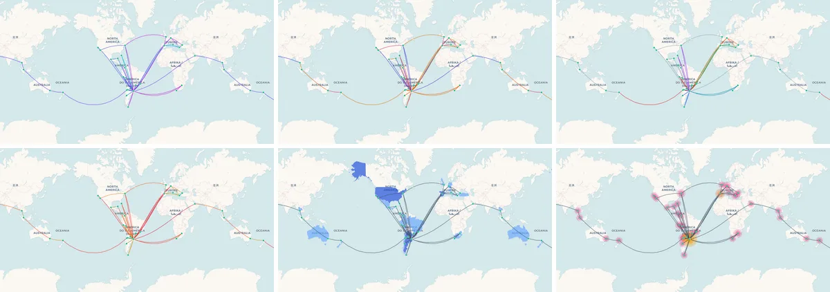
One history, six pictures. Top row: by year, time of day and by airline. Bottom row: by distance, countries and airport glow.
How to Colour Your Flight Map
- Add your flights: Type them in, click the airports on the map, import a CSV or scan your boarding passes.
- Open the map: Once you have three flights, the map modes panel appears in the corner of the map. Want it sooner? Turn it on from the map settings.
- Tap a mode: The routes recolour on the spot, with a key underneath that explains the colours.
- Keep tapping: Compare modes one after another. Your choice is remembered for next time.
- Hide it when you are done: Close the panel and your map goes back to its usual colours. Bring it back any time from the map settings.
Share It in Colour
The mode you are looking at goes with you when you share. A share image comes out in the same colours, a share video replays your journey with the countries lighting up and the airports glowing as each flight lands, and a share link opens straight into the mode you picked, where whoever opens it can switch modes too. Watch your own replay in countries or airport glow mode and the map builds up flight by flight, instead of showing how it ends from the start.
What People Find in Their Colours
The same flights, a different story in each mode:
- Frequent flyers checking whether their loyalty really goes to the airline they think it does
- Travellers watching their map spread year by year, from the first trips to the latest
- Night owls counting their red-eyes, and early birds their dawn departures
- Expats and commuters seeing which airports are their true home base
- Anyone who has lost count of the countries they have flown to, and wants to see them filled in
Frequently Asked Questions
Is the colour-coded flight map free?
Yes. Every map mode is part of My Flight Routes and free, with or without an account. As a guest your flights stay in your browser; an account keeps them across devices.
What information does each mode need?
Countries, distance and airport glow only need the airports, so they work with any flight. Colouring by year needs dates, by time of day needs departure times, and by airline needs the airline. A flight missing that detail is drawn in grey, and a mode with nothing to colour yet tells you what to add.
How are countries counted?
A flight counts once for each country it touches: a domestic flight once for its country, an international one once at each end. So a country in the darkest shade is one you have flown to or from at least five times.
Can I share my map in a map mode?
Yes. Share images and share videos use the mode you are looking at. A share link opens in it too, as long as the link carries what the mode needs: colours by year and airline need a saved link from a signed-in account, and time of day is not kept in shared links.
Does it work with a big flight history?
Yes. Switching modes only changes colours, it does not redraw your map, and the country shading and airport glow are drawn in a way that stays fast with hundreds of airports.
Your flights already hold the story. Pick a colour and read it.